File:StamfordPhillips&Hunt OS1886.jpg: Difference between revisions
Jump to navigation
Jump to search
(File uploaded with MsUpload) |
No edit summary |
||
| Line 1: | Line 1: | ||
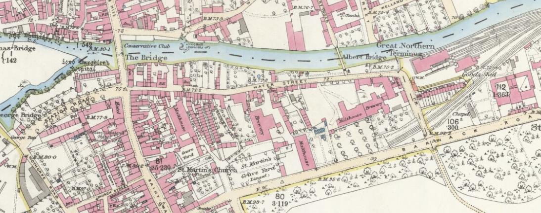
'''Ordnance Survey extract from 1886, showing Water Street: Phillips' brewery on the left and Hunt's brewery on the right. Reproduced with the permission of the National Library of Scotland (http://maps.nls.uk/index.html)''' | |||
Latest revision as of 10:41, 9 August 2019
Ordnance Survey extract from 1886, showing Water Street: Phillips' brewery on the left and Hunt's brewery on the right. Reproduced with the permission of the National Library of Scotland (http://maps.nls.uk/index.html)
File history
Click on a date/time to view the file as it appeared at that time.
| Date/Time | Thumbnail | Dimensions | User | Comment | |
|---|---|---|---|---|---|
| current | 10:37, 9 August 2019 | 1,094 × 432 (123 KB) | SteveP (talk | contribs) | File uploaded with MsUpload |
You cannot overwrite this file.
File usage
The following 2 pages use this file: