File:EttingshallBry OS1913.jpg
Jump to navigation
Jump to search

Size of this preview: 320 × 141 pixels. Other resolution: 987 × 434 pixels.
Original file (987 × 434 pixels, file size: 116 KB, MIME type: image/jpeg)
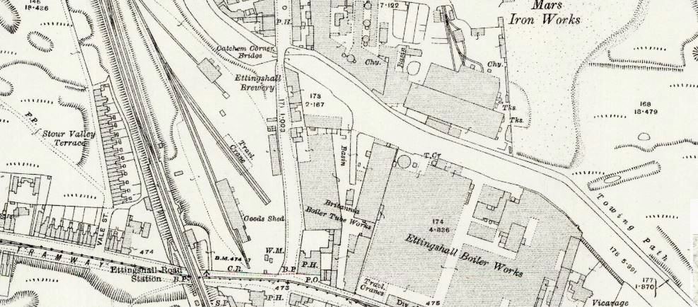
The "Ettingshall Brewery" is shown on this 1913 Ordnance Survey map, but is not shown on the 1901 or 1938 editions. Could this be Mears & Co's brewery? Reproduced with the permission of the National Library of Scotland (http://maps.nls.uk/index.html)
File history
Click on a date/time to view the file as it appeared at that time.
| Date/Time | Thumbnail | Dimensions | User | Comment | |
|---|---|---|---|---|---|
| current | 12:35, 19 March 2020 | | 987 × 434 (116 KB) | SteveP (talk | contribs) | File uploaded with MsUpload |
You cannot overwrite this file.
File usage
The following page uses this file: